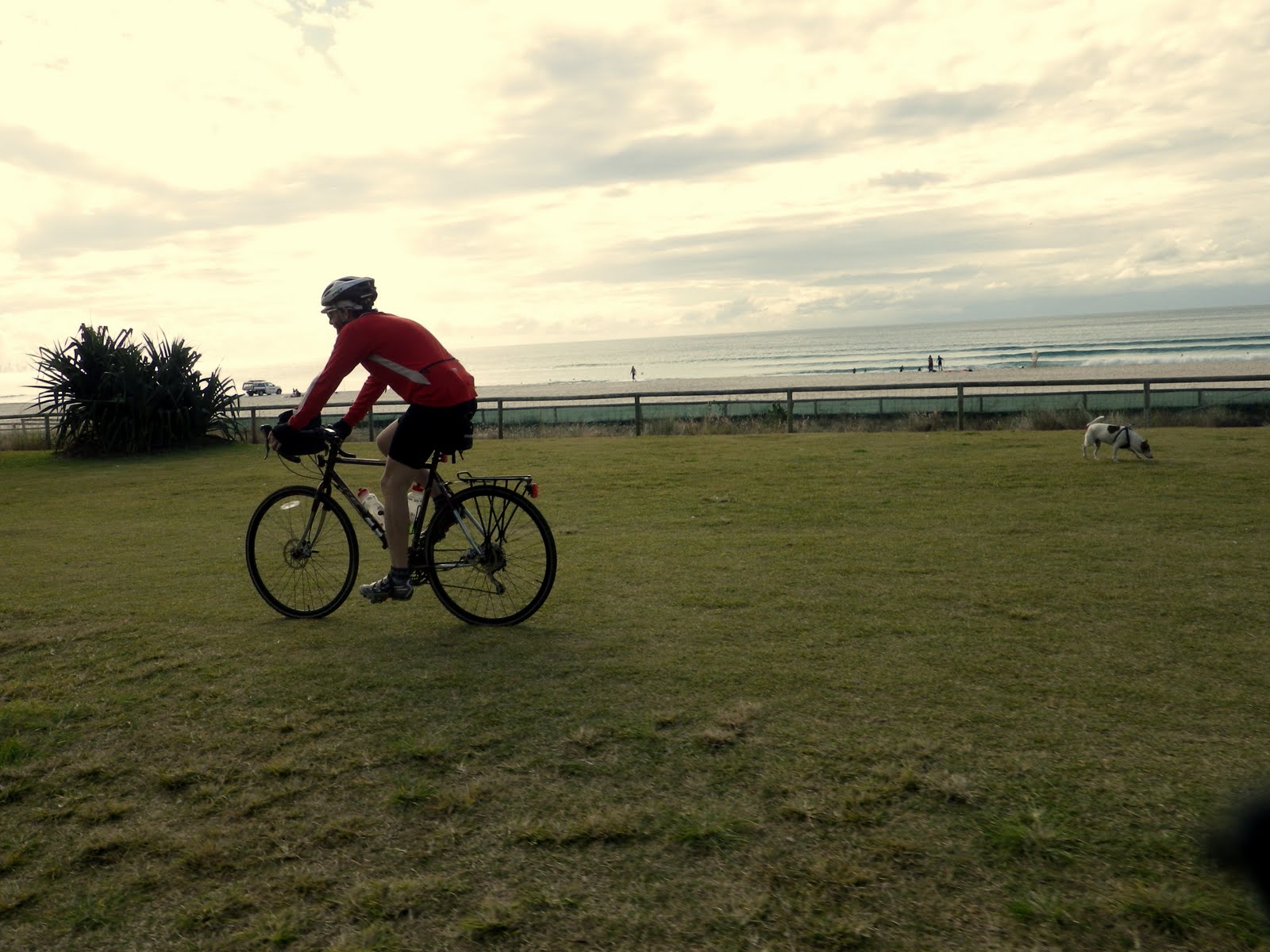
Getting out of town. Again.
Riding the Brisbane Valley Rail Trail is something I've been meaning to do for ages. The trail starts around about an hour west of Brisbane, and runs through the Brisbane Valley, from near Ipswich in the south, to the town of Blackbutt, about 150km to the north. Motorised vehicles are prohibited, it's only open for horses, hikers and cyclists. It's pretty much right on my doorstep, but for some reason I've always thought it was some kind of impossibly epic adventure. However, after my revelation last month that I can just jump in my car and drive somewhere new to go for a ride, I decided to finally see what all the trail hype was about. A quick check of the rail trail website revealed most of the trail is still pretty smashed up from the January floods and not open to the public, but the northern section of the trail from Moore to Blackbutt re-opened last month, so I resolved to go and check it out the following day.
The morning of departure was unusually cold and overcast in Brisbane. It wasn't really threatening to rain, but the sky was a uniform grey colour, and the temperature around 10 degrees Celsius. On my way out of town I picked up my mate Rudi and his touring bike. For those who don't know Rudi, he joined me on a South Island New Zealand mountain biking trip last year, and is good value to have around, as he can usually be egged into doing stupid things on a bicycle. After an hour of driving we were well and truly out of the metropolis of Brisbane, and in the country town of Kilcoy. No visit to a country town is complete without stopping at the local bakery for the breakfast of champions - a hot pie and a chocolate milk.

Breakfast of champions, from a pie's point of view
The trail begins
Fifteen minutes drive later we arrived at the small town of Moore, and proceeded to try to find the trailhead to park the car and get underway. After a short but confusing drive around the deserted streets, we parked out the front of what might have been the local school and prepared to head off towards the township of Linville along the first section of trail. Neither of us had any clue where we were going, and there was nobody around to ask, so we rolled around on our bikes until we eventually found a sign pointing us in the right direction.


I think we're meant to go that way
Our initial impression of the trail was not what we expected. At the Moore trailhead it was rough, overgrown, and the track seemed to consist solely of a series of short, sharp 20% climbs and descents. Nothing more than about 15 metres per climb, but this was definitely not an old rail route, it was more like an extreme off road vehicle track. Even on a mountain bike it would have been difficult, on a touring bike it was diabolical. What made the whole experience even more frustrating was the fact the paved road to Linville was only about 10 metres parallel to the track we were battling along. After about 200 metres of getting jarred to pieces on the rough trail, we rode across the easement and proceeded up the road towards Linville, to see if the trail improved further along the line.

This first section was actually along a phone cable easement and was unrideable on a touring bike

Empty country road to Linville
About 5km along we came to a sign and a gate where the trail crossed the road, and we decided to leave the pavement and have another go at the rail trail. We were immediately rewarded by being on the rail trail proper. Easy gradient, solid and smooth riding surface gently snaking around the contours of the creek, through cuttings and across embankments, all the way into Linville train station of yesteryear.

I *think* this was Rudi impersonating the hiker on the sign, but it took me until just then to get it

My advice is ride up the road to the start of the railway section of trail 5km north of Moore

Smooth, flat, secluded, silent, sublime. This is what rail trails are about

Make gates your friend. There are a few today

Rudi wobbles towards an abandoned train at an abandoned station in the distance

Historic rail carriages on the trail

For those wondering, the carriages were full of old bathroom sinks!

This carriage appeared to be homemade and was therefore awesome

The restored Linville station building

The train to nowhere, with the Linville pub in the background
The ascent
We spent a little while exploring the old carriages and buildings under the light grey sky. It was a pretty weird vibe - not a soul around besides ourselves, and everything was bathed in that kind of strange light that casts no shadow. The weather and isolation made it seem like we were on another planet most of the day, in fact we didn't see another person on the trail the whole time. Eventually we made our way to the northern end of the rail yard, where the rail trail turns sharply to the south-west, and began the steady, gentle climb up Blackbutt Range. The great thing about rail trails is they follow the path of least resistance, skirting the contours and going through numerous cuttings in order to maintain the gentle angle required for a ye olde steam train to climb. From here it was away from the road, away from towns and buildings, and upwards to our destination at Benarkin on the top of the range.

Out of Linville station and up the range

None of the bridges remain on this section of the trail. Every creek crossing requires a steep scramble down to the water then back up the other side.

Rudi gnaws a cow bone, Bear Grylls style. As you can see, without Jer there, I struggled with the photography side of things!

Open grazing land on the lower slopes of the range

One of many cuttings through the spurs of the valley, to keep a constant gradient for the old steam trains.

Destination: up there somewhere
The trail surface through the grazing land was solid, littered with small rocks and a little bit churned up from cattle, but still entirely pleasant. We were riding along at about 15km/h, a good pace that allowed us to take photos, have a chat, enjoy the view, and avoid most of the cow shit on the trail. At around 6km up the range, we came to an old ganger's shed under a mango tree, overlooking a bubbling stream in the valley far below. It was the perfect spot to shelter from the wind and the cold, have a bite to eat, and admire the view.

Taking a break in the ganger's shed. The shed and the whole trail was completely free from vandalism and litter, a rare find in south-east Queensland

We were slowly climbing out of the grazing lands into the forested high country

I reckon most of the area is unchanged since the railway was here, it was easy to imagine what it must have been like in the olden days
Into the forest
We continued the climb up the range, although in reality the angle is so gentle, it barely feels like a climb at all. About 1km uphill from the shed, the vegetation dramatically changed to a closed Eucalypt scrub as we entered Benarkin State Forest. With the change in vegetation the terrain became a little more dramatic, with a series of about 4 steep creek crossings with no bridges. I had heard these creek crossings were pretty hardcore, but I think whoever thought that was exaggerating a lot. Despite having entry and exit gradients of around 30%, they were not big and each one could easily be negotiated in about 30 seconds, even on foot. In the creek beds it was surprising to see evidence of the January floods this close to the top of the range - most of the creeks we crossed in the forest were a jumbled mess of smashed up branches, trees and rocks.

One of the creek crossings. Back in the day a rail bridge would have been here

At least the pinches back out of the creeks weren't very long.

New bike racks, toilet and sheltered picnic tables, in the middle of nowhere, exclusively for trail users. Awesome

The rougher creek crossings are marked with a black diamond, which made me feel quite "extreme"

My photography skills failed me here, but this was 30% in and out and very slippery. The toughest crossing on the route, but very small in the scheme of things.
With the creek crossings out of the way and the last of the gates done, the trail entered the dense vegetation close to the top of the range. In parts the forest canopy completely enclosed the trail, and the understory of vegetation was full of ferns and lush grasses, in contrast to the mostly dry grazing land we started from. The temperature also dropped sharply in the dark under the trees. The quality of the track surface in the forest was excellent and continued on the same easy gradient, and so the pace rose significantly as we blasted through the forest. We were both looking forward to some hot food and a coffee at Benarkin, and we had the hammer down. In the forest we passed through a deep cutting, underneath the main D'Aguilar highway high over our heads.

Still climbing steadily upwards, but a lot faster and smoother

Typical fast flowing corner through Benarkin State Forest
By this time we had gone all quiet and the chatter had pretty much stopped, until Rudi said he was getting a bit tired. So I quietly increased my speed by 2km/h. After a few minutes of that he said he was getting really tired, so I picked it up by another 2km/h, and so forth. After a while I think he had cottoned onto my macho buffoonery and dropped back, leaving me to indulge my improbable Paris-Roubaix fantasies by myself. It was definitely one of the more enjoyable moments of riding I have ever had, blasting through the closed forest at full pace. Suddenly the forest gave way to a huge open grassed camping area, and we had arrived at the tiny township of Benarkin.

Rudi hammering it towards the township of Benarkin

Out of the forest and into Benarkin
Into the freezer
The tiny township of Benarkin seemed to consist only of a shop, a few houses, and an excellent free camping area. At around 500m above sea level, we'd gained 350m of elevation on our gentle 25km climb up the range. This was apparent in the different vegetation, and the fact it was freezing cold. And I mean COLD! We made our way down to the shop, shuffled inside to order some lunch, then tried to find a spot to sit on the veranda out of the biting wind. Even the local people were rugged up in heavy coats and gloves and beanies. I had a woollen jersey on so my top half was good, but with only cycling shorts on the bottom half, I was definitely feeling the chill.

One shop + couple of houses + camping area = Benarkin

I sure hope this place has hot food

Random assortment of groceries and bric-a-brac

Cold Frenchman looks cold

Trying to gracefully eat this monstrosity proved beyond my skills. It only cost me $6 and I made a pig of myself

Doing my "trying to keep warm" dance after lunch at Benarkin. It didn't work
We ate our lunch and drank our coffee in record time, largely as it was so cold we wanted to get moving quickly to warm up again. Rudi was a little worried about the time we'd get back home and was considering riding down the main highway to Moore, until the girl at the shop told us there was roadworks on the highway causing long delays. So it was with great delight I managed to convince Rudi to blast back down the range the same way we had come up. We crossed the road from the shop to wash up after lunch and get ready to ride, and the wind picked up and it suddenly got really, really cold. Rudi commented it was colder than the time in NZ we got caught out in the Southern Alps of New Zealand when the weather changed. I had to agree, it was biting, freezing, bitter cold. Turns out it wasn't my imagination when we got home and checked the weather data for the area. When we left to head back down the trail it was 3.5 degrees Celsius, and the coldest June day since 1913.
The descent
The ride back down through the Benarkin State Forest along the rail trail is one of the most entertaining rides I have ever had. The smooth gravel roads combined with the gentle downhill gradient meant we were easily sitting on 30-35km/h for what seemed like ages. Hurtling through the forest was the coldest I have ever been on a bike - I couldn't feel my feet, face or hands, and my nose was running and congealing on my face like an Antarctic explorer. The gradient and curves down through the forest were perfect as there was never any need to apply the brakes, which worked out well as I'm not sure my frozen hands would have worked anyway.

Start of the trail heading back down the range

Fast and freezing descent
Travelling off road at sustained high speed with little pedalling effort is a surreal sensation, and for me it felt like an eternity before we were back at the four sharp creek crossings, which were quickly and easily negotiated. Soon we were back out into the grazing country again as we continued effortlessly down the hill, and the scenic vistas opened up to the east.
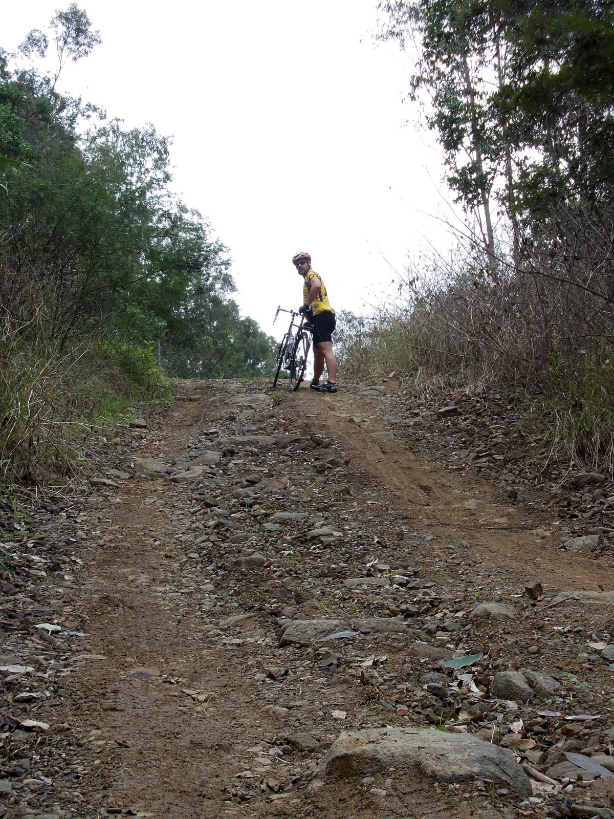
One of the steep slippery creek banks, photographed with no sense of perspective

The funniest part of Rudi using a horse hitching post for a bike...

...was watching Rudi struggle to get it back off again and panic a little bit

Out of the forest and back into the open country, and stepping in cow poo

Grass trees on the hillside

The only other trail users we saw all day

Another cutting on the descent

View of the trail below

The only photo in existence of Rudi actually standing to pedal his bike. In all the years we've been riding, this is only the second time I've seen it happen myself

Getting close to the bottom of the trail now

Under the bridge at Linville. Appropriate references to the song were made
Upon our arrival back at the old Linville station, we decided to forego the last section of rail trail and blast back up the road to get back to the car, mostly to get out of the cold a bit sooner. We cut across a park toward the pub, which was closed, and saw two local guys sitting on a bench, drinking rum cans in the deserted street, at two o'clock in the afternoon on a Thursday. They were keen to hear about our experiences on the trail, and were justifiably proud of their hometown and the trail. When they asked us how long we took to get down I pulled a time out of the air and said it took us an hour, which must have been the correct answer as they did the pursed lip thing and made impressed noises. We left the guys to their icy afternoon drinks and headed back to the car.

The final dash back to the Moore trailhead
Back at the car we got changed, loaded up the bikes, and fired up the heater to maximum as we headed back into Kilcoy for afternoon tea, where it was already starting to get dark at about 3:45pm. Within an hour we back in Brisbane city, back in the peak hour rush and the day to day grind of life in a metropolis. It was something of a culture shock, we felt like we'd been in a different world out on the isolated trails all day.
Lessons learned
Sitting at home later that night in the freezing cold reflecting on my day, I came to realise my little rail trail day trip had quite a profound effect on me. For starters I am an instant convert to rail trails - they are an amazing way to enjoy obscure parts of the countryside by bike, and I'll be making a more concerted effort to enjoy the rail trails of Australia more often. I also gained a greater appreciation for my bike and gear - all day the bike was rock solid, fast, smooth, and pretty much the perfect tool for the job.
As some may know, I'm doing a cycling tour around the South Island of New Zealand again this year, including the Otago Rail Trail. My jaunt on the Brisbane Valley Rail Trail taught me a few lessons for that trip as well. Namely, that woollen jerseys and leg warmers are a must have, and that I'll be limiting my rail trail distance to 50km per day to allow maximum time to take photos, muck around, and generally soak up the atmosphere without having to rush.
And to anyone thinking of giving the Brisbane Valley Rail Trail a go themselves, I highly recommend it. And if you need a riding buddy up to Benarkin, I'm keen to go again!
Addendum 25th September 2011: Went out on a short ride to Samford, and managed to find some rail trail starting only 6km from my house in Brisbane, including an abandoned railway tunnel built in 1918. It's a great way to sample what rail trails are all about, only a short ride from Brisbane city.